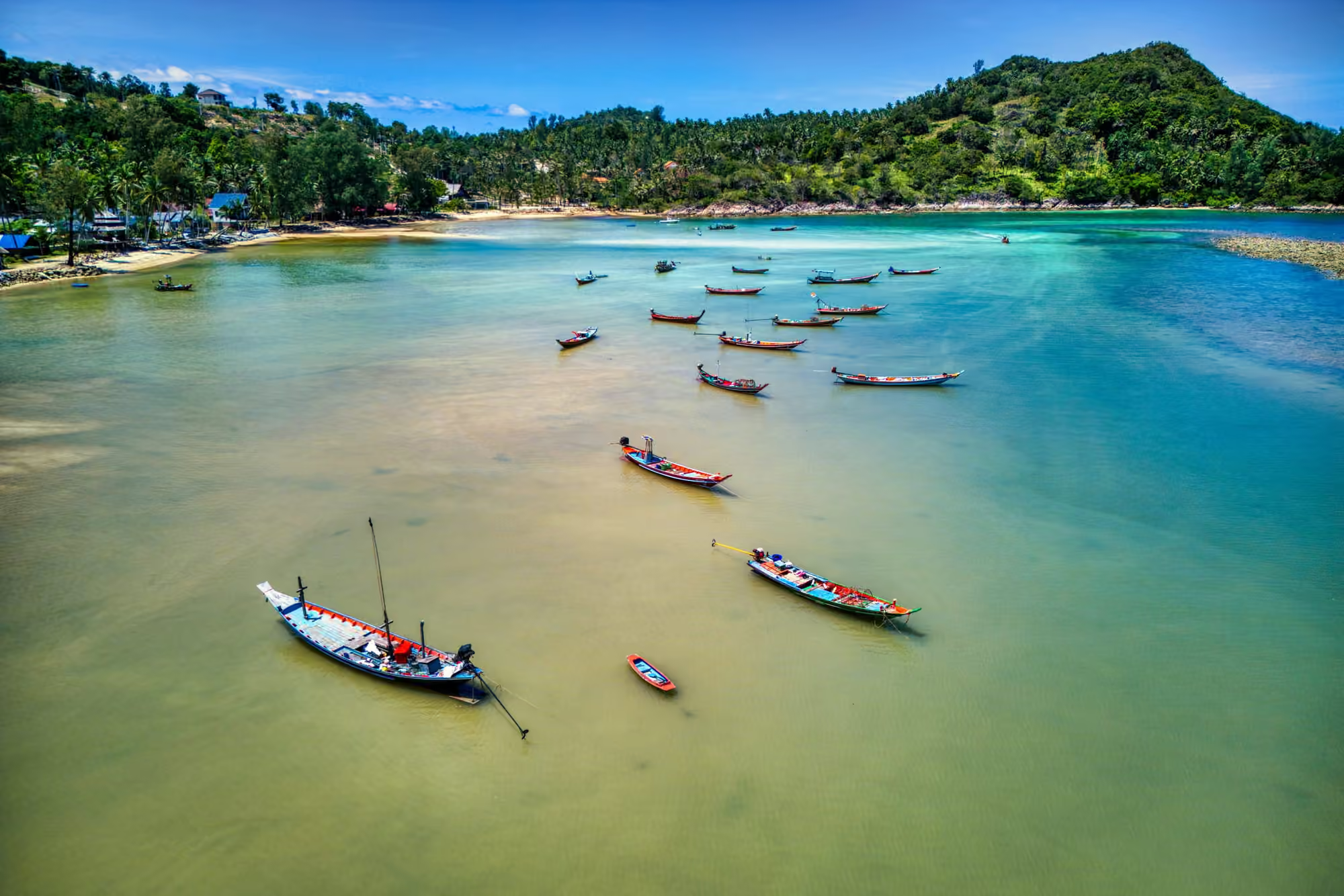
Photo: Hagai Agmon-Snir (resized, cropped)CC BY-SA 4.0source

History and culture · 19 stories
Koh Phangan history and legends: kings, temples and sea stories
A sandbar said to have given the island its name, a king who visited the same stream 14 times, women who paddle the Buddha across the bay: Koh Phangan's history and legends, with every source shown.
On this page
How to read this page
Every story carries one of four labels. The label says how well the sources support a story, not how good the story is.
- Documented11 stories
Confirmed by at least two sources, at least one of them an official record, a primary document or academic work, or by one published academic field study.
- Oral tradition3 stories
Told on the island and written down by a named source, without confirmation in any record.
- Disputed3 stories
The sources disagree. We print both versions and what each one rests on.
- Popular story2 stories
Widely repeated, mostly in travel writing, with no record behind it. Read it as a story.
Which sources weigh most
- Official recordsFine Arts Department, Tourism Authority of Thailand, national parks, the Royal Gazette
- Academic workJournal articles, theses and museum catalogues
- PressDated newspaper and magazine reports
- Oral accountsWhat residents and monks tell, as written down by a named source
From strongest to weakest. A story is labelled by the strongest sources that support it.
Koh Phangan is known abroad for one night a month. The island’s own record is older and stranger: a name said to come from a sandbar, a capital that looked across to Chaiya on the mainland, a king who visited the same stream fourteen times and another who shot a film on the island, a nun who built a monastery against the conventions of her time, and a festival in which women paddle the Buddha across the bay.
This page gathers 19 of those stories. Each one carries a label. Documented means the facts rest on at least two sources, one of them primary, official or academic, such as the Royal Gazette or a peer-reviewed study, or on a single published academic field study when that study is the only record of a community. Oral tradition means the story is told and someone has written the telling down, which is not the same as it being true. Disputed means the record and the telling disagree, and we show both side by side. Popular means a story that circulates widely, mostly in guidebooks and online.
Where sources disagree on a date or a number, we give both and say who says what. Where nothing has been recorded, we leave the gap open rather than fill it. The district motto, in its longer form, reads almost like a table of contents for this page. It opens with Rama V and Than Sadet, names the monk Luang Pho Phet, runs through the beautiful moon, the clear sea, white sand and sparkling coral, and ends with “diamond of the Gulf, town of good people” [39].
The stories
Timeline
Every date links to its story and carries the story’s label. Where a date itself rests only on the press or on secondary sources, it says so. Dates marked c. are estimates.
5th century BCE
19th century
- Under Rama IV (1851 to 1868) Phangan is placed under Chaiya and governed from Ban Wok TumDocumented
- In Nirat Pak Tai a royal poet tells the Ta Mong Lai legend, then sails past Phangan and SamuiOral tradition
- Nirat Mueang Palian retells the legend on a voyage past Samui and PhanganOral tradition
- Prince Bhanurangsi’s inspection finds about 300 Thai and Chinese households paying yearly cash dues under a tin levy or a birds’ nest levyDocumented
- King Chulalongkorn (Rama V) first visits Koh Phangan, dated 1888 or 1889 depending on the sourceDocumentedThis date: secondary sources only
- Thai Wikipedia, citing a local website, dates the founding of Wat Phu Khao Noi by the monk Luang Pho Phet to this yearDisputed
- Than Praphat is named on a royal tour of Ban Don Bay; a royal monogram dated Rattanakosin year 108 survives upstreamDocumentedThis date: one press report
- A local government reform abolishes the town of Phangan and folds it into Ko Samui districtDocumented
- Than Prawet, the third royal stream, is namedDocumentedThis date: one press report
20th century
- Last of the 14 visits by Rama V counted in Thai sourcesDocumentedThis date: secondary sources only
- King Vajiravudh (Rama VI) visits, as dated by a local writerOral tradition
- King Prajadhipok (Rama VII) visits in 1926 and again in 1928, years a local writer reads from his inscriptionOral tradition
- King Prajadhipok films the silent drama Waen Wiset (The Magic Ring) on the islandDocumented
- Villagers remember the sea Chak Phra already being held in three baysDocumented
- The abbot of Wat Rat Charoen moves the festival to the 8th day of the waning moonDocumented
- King Bhumibol (Rama IX) visits Than Sadet, as dated by a local writerOral tradition
- The abbot of Wat Rat Charoen founds a forest park at Phaeng waterfall, by the park department’s account; EcoThailand dates his first survey there to April 1968Documented
- Luang Ta Lop of Wat Rat Charoen revives the sea Chak Phra in Thong Sala bayDocumented
- Phangan becomes a minor district on 1 October, still spelled without its short a vowelDocumented
- A royal decree makes Koh Phangan a full district from 13 AprilDocumented
- The district decree writes the name with the short a vowel, the spelling used sinceDocumented
- The forest at Phaeng waterfall becomes an official forest parkDocumented
- Mu Ko Ang Thong becomes a marine national park on 12 NovemberDocumentedThis date: secondary sources only
- Koh Tao becomes a subdistrict of Koh Phangan district; government tourism promotion beginsDocumented
- Year of the first Full Moon Party in Paradise Bungalows’ own founding storyDisputed
- Large car ferries start, bringing vehicles and building materials to the islandDocumented
- A rival full moon party at Haad Rin Nai draws about 300 locals and guests, as a witness remembered it for Bangkok PostDisputed
- Paradise Bungalow’s owners throw a farewell party for Australian travellers, the start date given by a 2011 Ministry of Culture studyDisputed
- Rosemary and Steve Weissman arrive at Wat Khao Tham with a letter of introductionDocumented
- The Weissmans become resident teachers of the monastery’s meditation retreatsDocumented
- Mains electricity arrives, by one expat’s memory in about March 1989; no official date has been foundOral tradition
- The Chao Mae Kuan Im shrine is finished on the road to Chaloklum, according to a travel guidePopular story
- Local government starts funding the sea Chak PhraDocumented
21st century
- Mu Ko Ang Thong is listed as Ramsar wetland site no. 1184 on 14 AugustDocumentedThis date: secondary sources only
- The Thai Film Archive names Waen Wiset national film heritageDocumentedThis date: secondary sources only
- Bangkok Post reports up to 30,000 people at the monthly party on Haad Rin NokDocumentedThis date: one press report
- After a complaint, construction of an airport at Thong Nai Pan is suspended, and forestry officials find that land prepared for it encroaches on about 20 rai of park landDocumentedThis date: one press report
- A royal decree signed on 18 November and published on 22 November creates Than Sadet-Koh Phangan National ParkDocumented
- The Full Moon Party is suspended because of Covid-19DocumentedThis date: one press report
- A mammal survey of the island’s forests begins in February and runs to September 2023Documented
- The Full Moon Party returns at full scale on 16 AprilDocumentedThis date: one press report
- A Thammasat University journal publishes a study of the Tanka boat people of Thong Sala; its author found almost no earlier research on Tanka history in ThailandDocumented
- The survey is published: 28 mammal species, including Sunda pangolins and slow lorisesDocumented
Where the stories happened
Numbers match the chapters. A ring around a number marks a place known only by its area.
Where several stories share a place, their pins sit in a small circle around it.
Places on the map
- Ko Ma · Haad SaladThe island named after a sandbar
- Ban Wok Tum · Wok TumWhen Wok Tum was the capital
- Nam Tok Than Sadet · East coastThe king’s stream
- Wat Phu Khao Noi · Thong SalaThe temple on the small hill
- Ao Than Sadet · East coastA king’s film on Phangan
- Wat Rat Charoen · Thong SalaPulling the Buddha across the bay
- Thong Sala (area only)The boat people of Thong Sala
- Ban Chalok Lam · ChaloklumChaloklum and the fishing coast
- Hat Salat · Haad SaladThe pirates of Haad Salad
- Hat KhuatWhy Bottle Beach is called Bottle Beach
- Tha Ruea Thong Sala · Thong SalaFerries, bungalows and a district
- Wat Khao Tham · Thong SalaThe nun on the cave hill
- Hat Rin Nok · Haad RinWho threw the first Full Moon Party
- Nam Tok PhaengThe monk who started a national park
- Khao RaKhao Ra and the hidden mammals
Chapter 01. Name undated, spelling 1970 to 1977 · Ko Ma
The island named after a sandbar
Oral traditionIn short: The accepted local explanation derives Phangan from lang ngan, a sand ridge that surfaces at low tide; another account gives an older name, Ko Raham. Only the spelling is documented: it changed in the gazettes between 1970 and 1977.
Koh Phangan, most explanations agree, is named after something you can only walk on at low tide. The account repeated by the Sirindhorn Anthropology Centre’s community archive and by Thai travel writers derives the name from lang ngan, a southern Thai dialect word for a ridge of sand that rises out of the sea when the water drops; the short a vowel, the story goes, was added later [1][2]. The anthropologists present it as a presumption rather than a finding, and no linguistic study has settled it.
A Thai government research report offers a variant reading: pha, to meet, and ngan, a sandbar seen at low tide [3]. The Tourism Authority of Thailand records a different line altogether. A former Ko Samui district chief, it says, remembered the island as Ko Raham, “the shadowy island”, which TAT takes as a hint of early Malay settlers [4].
The written record is firmer about spelling than about meaning. The 1970 Interior Ministry announcement that made the island a minor district writes เกาะพงัน, without the vowel; the 1977 royal decree that made it a full district writes เกาะพะงัน, the form used ever since [5][6]. The older spelling never quite disappeared: a 2009 Manager Online feature still uses it [7].
If you want to see the idea rather than read about it, go to Mae Haad (Mae Hat) on the northwest coast at low tide. Thai Wikipedia notes that a sandbar surfaces there and lets people walk across to Koh Ma [8]. No source ties the island’s name to this particular sandbar, but it is the clearest picture on the island of what lang ngan describes.
Where to see it today
- Place
- Ko Ma
- Area
- Haad Salad
- Access
- Open to visitors
Off Mae Haad beach on the northwest coast. At low tide a sandbar lets people walk across to Koh Ma.
Villas in Haad SaladChapter 02. Before the 19th century
Who came first
DisputedIn short: No archaeological find from Phangan itself has been documented; the bronze drums often cited come from Samui. Who settled the island first is a set of competing hypotheses, from sea nomads to mainland fishing families.
Nobody knows who first pulled a boat up on Phangan’s beaches, and the honest answer starts on another island. The bronze kettle drums of the Dong Son type that are cited as evidence of early settlement in this part of the Gulf were found on Koh Samui, at Wat Taling Phang and Wat Lamai [1]. English Wikipedia, drawing on a travel writer, uses a drum found on Samui to argue that people lived on Samui, Phangan and the surrounding islets more than 2,000 years ago, and dates it to 500 to 100 BCE; the Thai report calls the drums about 3,000 years old [2][1]. No comparable find from Phangan itself has been documented.
Into that gap come the hypotheses. The Sirindhorn Anthropology Centre’s community archive reports a belief among some historians and archaeologists that the first arrivals were Muslim sea nomads from the Malay Peninsula, and glosses them, in English, as “Pygmy, Semung and Proto-Malay” [3]. English Wikipedia speaks more cautiously of Austronesian peoples arriving by boat from the peninsula [2].
The 2011 report published by Thailand’s Department of Cultural Promotion offers a mainland answer. Drawing on the notes of Luang Ta Lop (Phra Khru Suphattharathammaphirom), the abbot who founded the forest park at Phaeng waterfall (see The monk who started a national park), it records the presumption of some historians and archaeologists that the first settlers were fishermen from Nakhon Si Thammarat or Pattani. Among the earliest migrants it lists people from Samui, Chaiya, Tha Sala, Don Sak and Pak Phanang, drawn by bays where boats could anchor [1]. It also quotes a local magazine that hears Malay in old names, Ko Rahan for the island and Loh-da-lam for Chaloklum (Chalok Lam), and it files that idea, too, under presumption.
What can be said is modest. By the 19th century the island was a place of fishing and coconuts, settled from the coasts around it (see When Wok Tum was the capital). Everything earlier is inference.
Chapter 03. Told at sea, 1859 and 1879
The legend that sailed past
Oral traditionIn short: Ta Mong Lai, the great origin legend of the Gulf of Thailand, turns a wedding quarrel into islands and headlands. Nineteenth-century poets told it on voyages that carried them past Phangan, but none of its 16 recorded local variants is set on the island.
Ask along the Gulf coast how its islands came to be and you may hear the story of Ta Mong Lai. In the version a royal poet wrote into his travel poem in 1859, a suitor named Chao Lai asks for the daughter of Ta Mong Lai, while the lord of Laem Sing courts her through her mother. Each parent promises her to a different man, both wedding parties arrive with their gifts, and the father, in his rage, tears the girl in two and throws one half to each suitor [1]. In the many tellings, the people and the wedding gifts become the landforms of the Gulf [1]: hills, headlands and islands from Phetchaburi and Prachuap Khiri Khan on the western shore to Chonburi and Trat on the eastern one [2].
Phangan has a walk-on part. The poet of Nirat Pak Tai, Krom Muen Amonmontri, told the tale while his ship waited out a storm off Phetchaburi, then sailed south past Pranburi and Sam Roi Yot, past Phangan and Samui, to Nakhon Si Thammarat. A second travel poem, Nirat Mueang Palian of 1879, tells the story again and again passes Samui and Phangan [1]. In a 2022 study’s summary of both voyages the island is written the old way, เกาะพงัน, without its short a vowel.
The same study lists 16 local variants that grew out of the legend. Only one is in Surat Thani province: Hin Ta and Hin Yai, the Grandfather and Grandmother rocks on Samui, where a betrothal party sets out and never arrives [1]. Geologists describe the pair as granite outcrops [3]. No Phangan site appears on the list.
Islanders may well tell versions of their own, but none has been written down in the sources we found, so we do not invent one. In the written record, Phangan is the scenery the poets sailed past while telling someone else’s story.
Chapter 04. c. 1851 to 1897 · Ban Wok Tum
When Wok Tum was the capital
DocumentedIn short: Before Thong Sala, the island was governed from Ban Wok Tum, which looked across to Chaiya on the mainland. A royal inspection of 1884 found about 300 Thai and Chinese households paying yearly dues under a tin levy or a birds’ nest levy.
For most of the 19th century Phangan looked west, to the mainland. According to the 2011 Department of Cultural Promotion report, the clear historical record begins under King Mongkut (Rama IV, 1851 to 1868), when Samui was placed under Nakhon Si Thammarat and Phangan under Chaiya [1]. The island’s seat was not at Thong Sala but at Ban Wok Tum on the west coast, then the most prosperous place on the island, because its bay suited sailing ships and lay close to Phumriang bay, the main crossing to Chaiya. The last governor, Luang Samut Khiri, was sent over by the governor of Chaiya.
The best snapshot of that island dates from 1884, when Prince Bhanurangsi inspected the southern provinces for King Chulalongkorn. His account, quoted in the same report from a 1961 edition, describes about 300 Thai and Chinese households, coconut groves fenced along the shore, and streams where gold and tin had once been found in the gravel [1]. The islanders fell into two tribute groups, both paying in money: those under the tin levy paid 7 baht 2 salueng a year, those under the birds’ nest levy 5 baht 2 salueng. The prince’s verdict was a gentle one: the islanders considered themselves happy; after their tribute and the occasional call for labour, they were not in hardship.
A Chinese strand runs through all of it. The report says Chinese migrants mined gold under Rama IV until it ran out, then panned tin from the stream gravels under Rama V; swiftlet nests were gathered on Koh Tae Nok and a scatter of smaller islets, and some Hainanese sailed junks trading mature coconuts and coconut oil [1]. The Sirindhorn Anthropology Centre’s community archive adds that the first Chinese on the island are said to have come to plant and gather coconuts [2].
In 1897 a local government reform abolished the town of Phangan and folded it into Ko Samui district under Chaiya, leaving two subdistricts, Koh Phangan and Ban Tai [1]. Wok Tum was a seat of government no longer. Tin mining, the report notes, has long since ended.
Chapter 05. 1888 or 1889 to 1962 · Nam Tok Than Sadet
The king’s stream
DocumentedIn short: King Chulalongkorn first came to Than Sadet in 1888 or 1889 and, by Thai counts, visited it 14 times. Four Chakri kings visited the stream, and royal monograms carved into its boulders still record them.
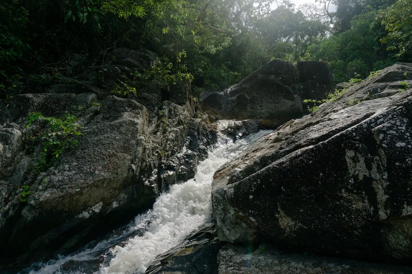

The name says it plainly: Than Sadet means, roughly, the stream the king went to. Thai community records give King Chulalongkorn’s (Rama V) first visit to Koh Phangan as B.E. 2431, which English Wikipedia renders as 1888 [1][2]. A 2009 Manager Online feature dates his visits to Than Sadet from B.E. 2432 to 2452, 1889 to 1909 [3]. Before 1941 the Thai year began in April, so the gap may be smaller than it looks; until someone reads the dates carved on the rocks, 1888 or 1889 is the honest answer.
On the number of visits the Thai sources agree: 14 [1][4][5]. Manager Online retells how the naming happened. The king’s map showed only fresh water at the spot; when he found a large stream instead, he enjoyed it so much that he gave it a name and had the year carved on the rock ledge at each visit [3]. The royal travel record behind that account has not been located, so read it as the story Thai writers tell.
The same feature credits him with two more names: Than Praphat, a small fall into the sea, named on a tour of Ban Don Bay in 1889, and Than Prawet, named in 1898 [3]. All three use royal vocabulary for a king’s journey.
He was not the last. The Ministry of Culture report and the Tourism Authority of Thailand list four Chakri kings at Than Sadet: Rama V, VI, VII and IX [4][5]. A local writer dates the later visits to 1911, to 1926 and 1928, and to 1962 [6]. Royal monograms, จปร for Rama V among them, are carved on boulders near the falls together with numerals and lettering, and Manager Online counts about ten inscription sites [3][7]. At Than Praphat the lettering at the fall has worn away, while a monogram dated Rattanakosin year 108 survives about a kilometre upstream [3].
Islanders regard the waterfall as sacred because of that royal history [1][3]. The rule for visitors follows: do not carve, write on, climb or damage the inscribed rocks [8].
Where to see it today
- Place
- Nam Tok Than Sadet
- Area
- East coast
- Access
- Open to visitors
Inside Than Sadet-Koh Phangan National Park on the east coast; the stream runs down to Than Sadet bay. Do not carve, write on, climb on or damage rocks linked to the royal inscriptions.
Villas on the east coastChapter 06. 1889, or c. 1400 in English guides · Wat Phu Khao Noi
The temple on the small hill
DisputedIn short: English guidebooks call Wat Phu Khao Noi the island’s oldest temple, founded around 1400. Thai Wikipedia, citing a local website, dates it to 1889 and to an island-born monk, Luang Pho Phet, whom the district motto still names.
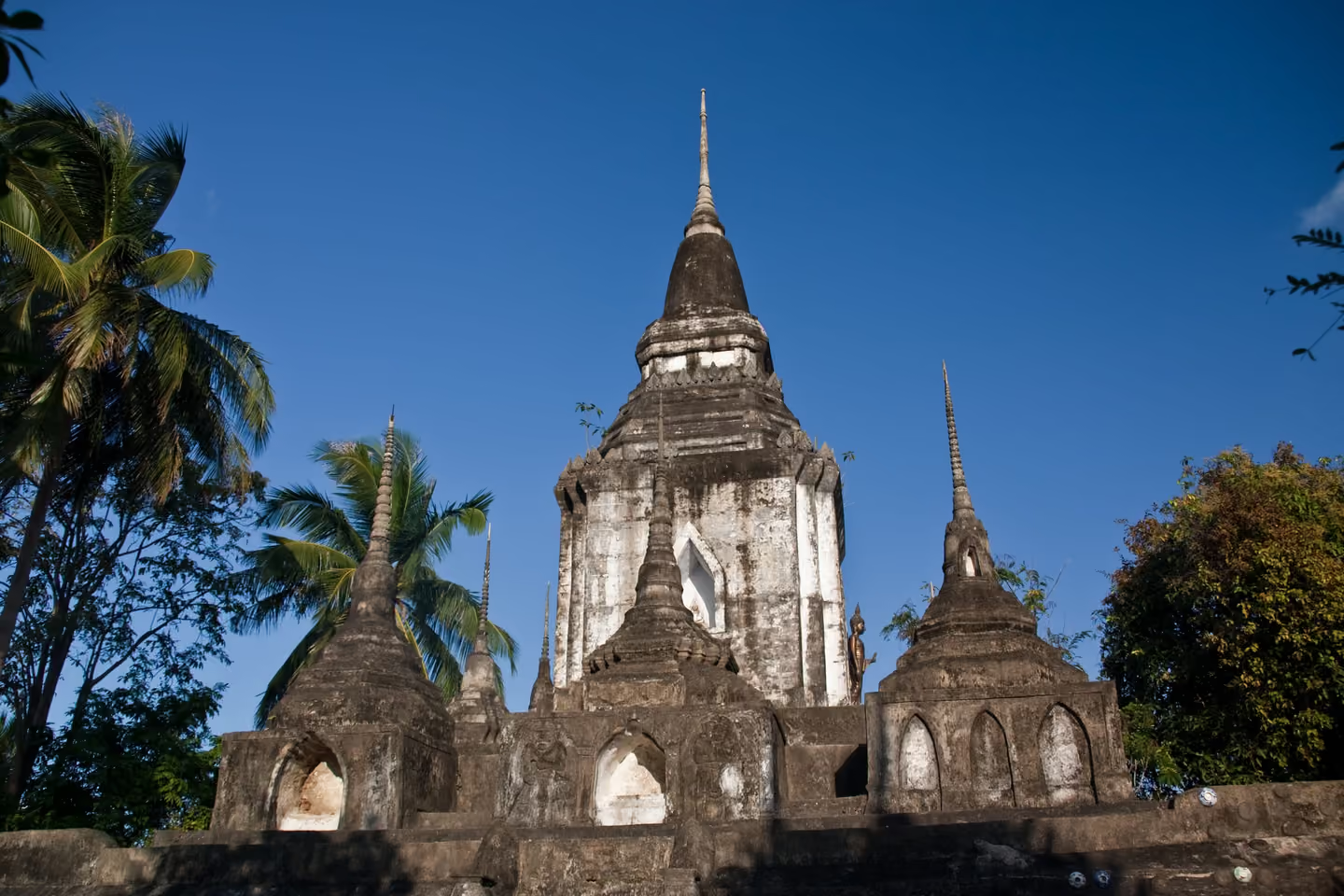

Read an English guide and Wat Phu Khao Noi is the oldest temple on Koh Phangan, founded around 1400 by the first monks to settle the island [1][2]. Read Thai Wikipedia and the date moves forward by almost five centuries. Citing a local website, it gives the founding as B.E. 2432, 1889, by Luang Pho Phet Wachiro, an island-born monk, also known by his title Phra Khru Wibun Thammasan, who served as head monk of Ko Samui district when Phangan was one of its subdistricts [3]. No primary or academic source for the 1400 date has been found. A shrine on the hill could be older than the monastery; nothing published shows it.
The hilltop chedi is said to enshrine relics of the Buddha [4]. The Ministry of Culture’s cultural database describes something less like the postcard stupa visitors expect: a tall reliquary chamber with false doors on four sides, set on a three-tiered base and crowned by a small bell and a five-ringed spire, ringed by six large and four small directional chedis that it believes are new construction [5]. Modern ceramic ware is set into the base, which English guides describe as upside-down bowls in the walls [5][1]. The database says the chedis are registered by the Fine Arts Department; the year 1997, repeated online, comes from a travel guide alone [5][1].
A further story, found on a property blog, says monks hid a precious relic here and that it has never been found [6]. No Thai source tells it, so treat it as an online story, not a local tradition.
The founder has fared better than the dates. Both versions of the district motto that we found name him, and the longer one opens with Rama V and Than Sadet, then Luang Pho Phet, the centre of hearts [7][8]. This is a working temple: cover shoulders and knees, take off your shoes before entering its buildings, and never touch or point at a Buddha image [9].
Where to see it today
- Place
- Wat Phu Khao Noi
- Area
- Thong Sala
- Access
- Open to visitors
An active temple on a small hill near Thong Sala. Cover shoulders and knees, take off your shoes before entering temple buildings, and do not touch or point at Buddha images.
Villas in Thong SalaChapter 07. 1929 · Ao Than Sadet
A king’s film on Phangan
DocumentedIn short: In 1929 King Prajadhipok shot a silent drama, Waen Wiset (The Magic Ring), on Koh Phangan that he wrote, directed and edited himself, with members of the royal family as the cast. In 2013 it was named Thai national film heritage.
In 1929 a king made a home movie on Phangan, and it became part of the national film canon. Waen Wiset, The Magic Ring, was shot on the island while King Prajadhipok (Rama VII) was travelling in the Gulf of Thailand. According to Pajaree Tachart, writing for Chulalongkorn University’s Arc of Memory project, he wrote the script and the intertitles of this silent film, set to a Thai classical score, and directed, edited and produced it himself [1].
The story is a fairy tale. A cruel stepfather abandons his children on the island; one of them meets a nymph who gives him a ring that grants wishes, and the children turn its magic against their stepfather [2][1]. “All the actors are the royal family and King Rama VII shot the film himself,” Chalida Uabumrungjit, deputy director of the Thai Film Archive, said when the 25-minute short was added to the national registry [2]. The film is credited to a pseudonym, Nai Noi Sorasak [3].
Where exactly the camera stood is told locally. A Than Sadet writer says the film was shot at Than Sadet bay and around the waterfall, and wonders whether the year should be 1928, the date of the king’s second inscription by the stream [4]. The Film Archive’s list and the Chulalongkorn study both give 1929 [3][1].
In 2013 the Film Archive named Waen Wiset national film heritage [3]. Than Sadet is visited today for its pools and its royal inscriptions (see The king’s stream); the bay at the mouth of the same stream is where the local account places a king’s film set.
Chapter 08. Remembered from c. 1932 · Wat Rat Charoen
Pulling the Buddha across the bay
DocumentedIn short: Villagers remember Phangan’s sea Chak Phra festival from about 1932. Women paddle the boats that tow the Buddha, men answer with seaweed and improvised boat songs, and Thong Sala bay is now its only stage.
Once a year, at the end of the rains, Phangan pulls the Buddha across the sea. In Chak Phra, literally “pulling the Buddha”, an image of the Buddha rides in a decorated boat that is towed in procession through the bay. When the custom began on the island is not known. Villagers interviewed for a 2015 study by Pankaew and Boonsuaykwan remembered it already running around 1932, at three temples in three bays: Wat Pho at Hua Thian pier in Ban Tai, Wat Amphawan at Wok Tum and Wat Rat Charoen at Thong Sala [1].
What sets Phangan apart, the interviewees said, is who paddles. The Buddha boat is towed by slender ruea mat boats seating six to eight, paddled by women, with a steersman who may be a man. Each crew wears one colour and changes it every day of the three-day festival; only the woman at the bow dresses differently. The men paddle their own boats outside the procession, throw seaweed at the women’s boats and trade courting boat songs with them, some written in advance and some made up on the spot. A man who can improvise is called mut to. Seaweed was the ammunition because it drifts into the bays in the eleventh lunar month, and a man could throw it only if he could sing. Touching the women’s boats or bodies was forbidden, and anyone who went too far could be struck with a paddle without blame [1].
The festival has nearly died more than once. Around 1949 the abbot of Wat Rat Charoen moved it from the first to the eighth day of the waning moon, perhaps because daytime tides were too low on the first day, or because that day was also the end of Buddhist Lent. It was revived at Ban Tai around 1963 and at Thong Sala from 1967; from 1984 the district chief paid for boat repairs and prizes, from 1987 Thong Sala has been the only host, and local government has funded it since 1995 [1].
The day is unsettled in print. The Sirindhorn Anthropology Centre’s archive gives the first day of the waning moon [2], the 2015 study the eighth. Check the local programme before you plan around it.
Where to see it today
- Place
- Wat Rat Charoen
- Area
- Thong Sala
- Access
- Open to visitors
The festival is now held only in Thong Sala bay. Sources disagree on the day (the 1st or the 8th day of the waning moon of the 11th lunar month), so check the local programme.
Villas in Thong SalaChapter 09. Mid-20th century to today · Thong Sala
The boat people of Thong Sala
DocumentedIn short: A 2024 study traced Hainanese Tanka families who lived on junks moored off Thong Sala’s Chinese quarter until the mid-20th century. Their gods, among them Guan Yu of the Wan Kao shrine, came ashore with them.
Thong Sala’s harbour once had a floating neighbourhood. In a 2024 study in the Journal of Liberal Arts of Thammasat University, Tawirat Songmuang traced the Tanka, the Chinese boat people, and found that most of those in Surat Thani came from Hainan and settled on Koh Phangan [1]. In the mid-20th century at least ten Tanka households, about 80 people, lived almost their whole lives on junks. A Hainanese man born in 1932 remembered more than ten boats moored in a row in front of Thong Sala’s Chinese community. The families later moved ashore and merged with the Hainanese community; only three households at Thong Sala market still identify openly as Tanka [1]. The author describes his paper as the first study to identify Tanka people in Southeast Asia.
One family explained their arrival with a broken mast. The grandfather, the father and an adoptive mother had sailed by junk from Hainan to Samut Prakan to fish, then worked the waters around Phangan; when the mast snapped near Chaloklum bay they could go no further and brought the boat in to Thong Sala [1].
Their faith travelled with them. Phangan’s Tanka revere Guan Yu, the protector of the Wan Kao shrine in Thong Sala. Fishermen asked him through a spirit medium which way the pomfret were running, and some gave up fishing and moved ashore on his advice. At Chinese New Year, boats at sea came back to Phangan to make offerings at the shrine [1]. The study also records offerings to Mae Ya Nang, the spirit of a boat’s bow, by a Tanka fisherman from Samui; Thai fishermen hold the same belief [1][2].
Older Chinese writing gives the Tanka a strange ancestor, the Luting, half fish and half human. The study retells the myth from Chinese and Hong Kong literature and notes that other Chinese groups passed it on as a way of marking the Tanka as outsiders of lower status [1]. It is not a story the Phangan families were recorded telling about themselves.
The study prints a founding year for the Wan Kao shrine that looks like a typing error, so we leave it out until the shrine itself can confirm it.
Chapter 10. 19th century to 1985 · Ban Chalok Lam
Chaloklum and the fishing coast
DocumentedIn short: The first islanders the record names were fishing people from Samui and the mainland coasts, drawn by safe anchorages. Chaloklum, in a deep bay on the north coast, is still the largest fishing community on the island.
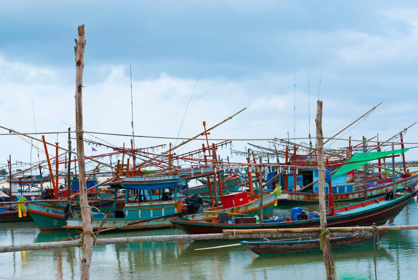

The first islanders the record names were fishing people. The 2011 Department of Cultural Promotion report lists early migrants from Samui, Chaiya, Tha Sala, Don Sak, Pak Phanang, Nakhon Si Thammarat and Pattani, drawn by bays where fishing boats could anchor; inshore fishing, it says, was the islanders’ first trade [1].
Chaloklum is where that life is easiest to see. The Sirindhorn Anthropology Centre’s community archive calls it the largest fishing community on Koh Phangan, set in a bay that hills shelter from the wind [2]. A Thai tourism listing links the name, โฉลกหลำ, to that shape: a deep, curving bay enclosed by mountains [3]. What the word means literally is not documented. A local magazine’s suggestion that it comes from a Malay form, Loh-da-lam, is labelled a presumption by the report that quotes it [1]. The Tourism Authority of Thailand still introduces the village through the life of its coconut farmers and fishermen [4].
The bay matters to the island’s other stories too. When a Tanka family’s junk lost its mast off Chaloklum, the accident decided where they would settle (see The boat people of Thong Sala).
The economy those families built held until the 1980s. The same report describes the turn: government tourism promotion from 1982 and large car ferries from 1985 changed an island of coconut groves and small-scale fishing into a modern community [1] (see Ferries, bungalows and a district).
The sea keeps its own customs. Thai fishermen traditionally believe that each boat houses Mae Ya Nang, a female spirit who lives in the bow, and pay her respect before they go out [5]. That belief is recorded for Thailand as a whole, not for Chaloklum in particular, so we give it as national custom rather than village record.
Chapter 11. Undated · Hat Salat
The pirates of Haad Salad
Oral traditionIn short: A legend recorded by a Thai community archive says Haad Salad takes its name from pirates who hid their boats in the cove to lie in wait for passing traders. The Thai word for pirate, chon salat, contains the beach’s name; no historical record of the pirates has been found.
Haad Salad (Hat Salat) has the most quotable folk etymology on the island. The Sirindhorn Anthropology Centre’s community archive records it as a legend: a band of pirates once moored and hid their boats here, and that became the origin of the beach’s name [1]. A Thai tourism listing supplies the motive. The cove, it says, gave the pirates a hiding place while they lay in wait for trading vessels crossing the Gulf of Thailand [2]. Thai Wikipedia repeats, without a source, that the beach was once a pirates’ hideout [3].
The language is what makes the story stick. The Thai word for pirate is chon salat, โจรสลัด, and the beach is หาดสลัด, Hat Salat. The English spelling, Salad, is simply a transcription of that second word; it has nothing to do with lettuce. The shared word is all the evidence there is. No historical record of pirates using this cove has been found. The archive and the tourism listing call the story a legend; only Thai Wikipedia states it as fact, and it cites nothing.
Read it, then, as the story the beach tells about itself: a name that has outlived any written account of how it was earned.
Chapter 12. Undated · Hat Khuat
Why Bottle Beach is called Bottle Beach
Popular storyIn short: Hat Khuat, Bottle Beach, is said to be named after its cove, which looks like a bottle from the rocks; Wikivoyage credits plastic bottles that once marked the hiking trail. Neither has an older or Thai-language source, and many of the island’s place names have no recorded story.
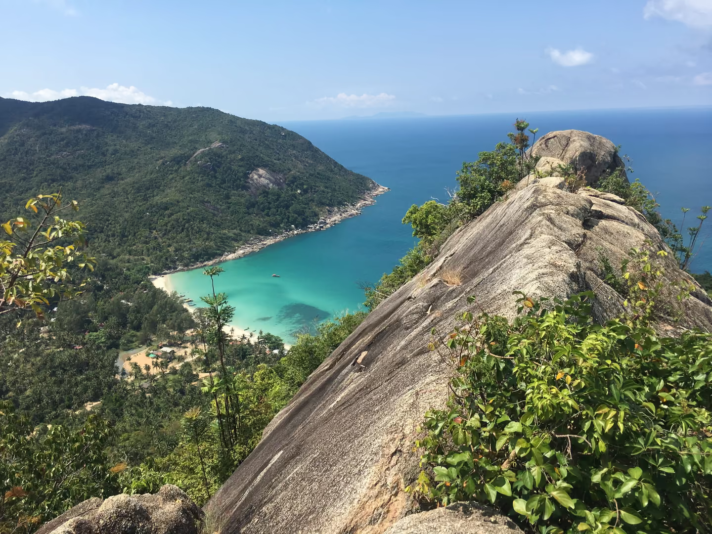

Bottle Beach is a translation. Its Thai name, Hat Khuat, means exactly that, and the explanation most often repeated comes from English Wikipedia. Its article cites a Rough Guide for the beach but gives no source for the naming; it says the beach was named for its protected cove, whose shape, seen from the rocks, resembles a bottle [1]. Wikivoyage tells it differently: the long hike to the beach, it says, gave the place its name, because plastic bottles were used to mark the trail [2]. No older or Thai-language source for either explanation was found, so treat both as guidebook tellings rather than a recorded event.
The cove is also one of the most isolated on the island. Wikivoyage describes it as reachable by long-tail boat from Chaloklum or by a long, tough hike, with a poor road as the third option [2].
Bottle Beach is lucky to have a story at all. Many of Phangan’s place names arrive with none. Hin Kong on the west coast is mapped in Thai as บ้านหินกอง, literally “pile of stones”, yet nothing we found explains which stones [3]. For Haad Rin (Hat Rin), Mae Haad and Thong Nai Pan we found no documented origin either. Where a story does exist, as at Haad Salad, it is usually a legend. Where none exists, we leave the gap open rather than fill it.
Where to see it today
- Place
- Hat Khuat
- Access
- Open to visitors
On the north coast. Wikivoyage says the easiest way in is by long-tail boat from Chaloklum; the road is rough.
Chapter 13. 1970 to 1989 · Tha Ruea Thong Sala
Ferries, bungalows and a district
DocumentedIn short: Between 1970 and 1989 Phangan became a district of its own, gained car ferries and saw hotels and resorts multiply. In the late 1980s, by one visitor’s memory, Haad Rin still had no concrete roads and the island had a single telephone.
In the space of twenty years Phangan stopped being a corner of Ko Samui district and became a destination. The paperwork came first. An Interior Ministry announcement dated 11 September 1970 made it a minor district from 1 October, with two subdistricts, Koh Phangan and Ban Tai; the document still spells the island without its short a vowel [1]. The 2011 Ministry of Culture report gives 23 October 1970 for the step to minor district; we follow the Gazette announcement, which sets 1 October [5]. A royal decree signed on 31 March 1977 and published on 12 April made it a full district from the following day; the same decree raised ten other minor districts across Thailand, on the shared grounds that they had grown more prosperous than before [2]. In 1982 Koh Tao became a subdistrict of the new district [4][3].
Transport followed. For decades overnight passenger boats from Ban Don, the town now called Surat Thani, carried the island’s goods. The 2011 Ministry of Culture report dates government tourism promotion from 1982 and large car ferries from 1985; the ferries could bring cars, tractors, trucks, buses and building materials, and with them came hotels and resorts [5].
Haad Rin, at the southern tip, became popular with backpackers in the 1980s [6]. One visitor’s memoir of the winter of 1988 to 1989 describes about half a dozen bungalow resorts there, no concrete roads, access only by long-tail boat and not a single motorbike on the beach; the only engine noise came from the generators of some resorts and from the boats. The island’s only telephone stood by the old post office in Thong Sala, and three minutes to Europe cost about 20 US dollars [7]. A Scottish expat interviewed in 2013 dated mains electricity on the islands to “about March of 1989” [8]. No official date has been found.
Those are single memories, and we label them as such. Put beside the gazettes, they show how quickly it happened. In 1977 a decree counted Phangan among districts more prosperous than before; in 1987 there was still no pier, and passengers climbed from the express boat into a long-tail and waded ashore through knee-high water [9].
Where to see it today
- Place
- Tha Ruea Thong Sala
- Area
- Thong Sala
- Access
- Open to visitors
Chapter 14. c. 1958 to 2013 · Wat Khao Tham
The nun on the cave hill
DocumentedIn short: Wat Khao Tham, the cave-hill monastery above Ban Tai, was built up by a nun, Mae Chee Ahmon, against the conventions of her time. From 1988 two Western teachers she had asked for ran meditation retreats there for 25 years.
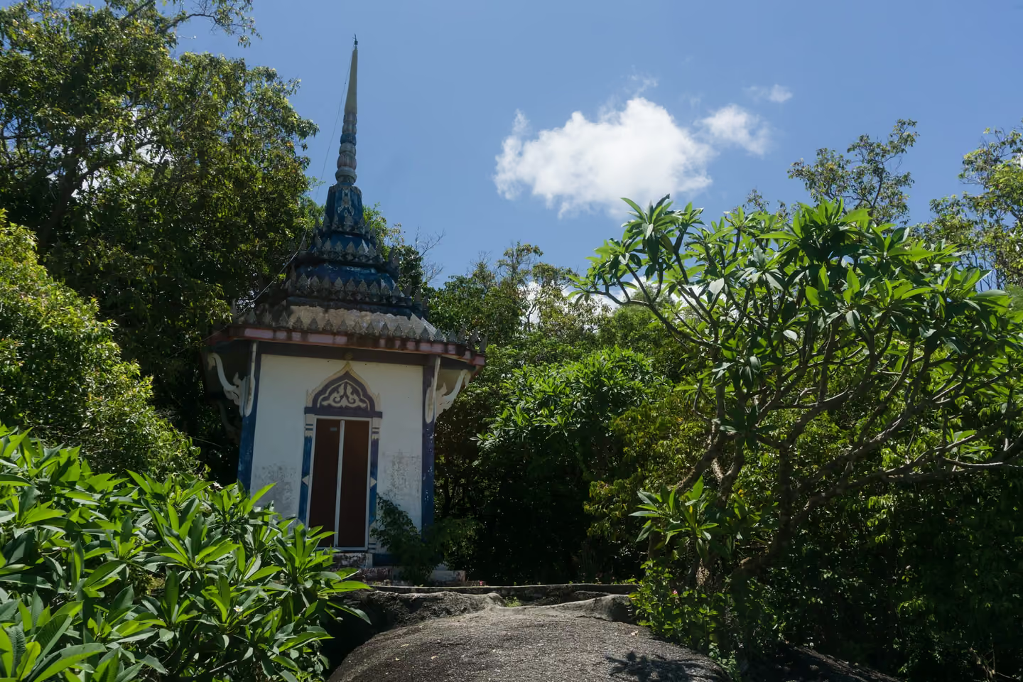

Wat Khao Tham, the Mountain Cave Monastery above Ban Tai, owes its shape to a woman. In 2009 the monastery’s website described Mae Chee Ahmon, then 86 and a nun for 51 years, as its guiding force, a woman “who ignored all the conventions of her time, to develop a small monastery on a rocky hill with magnificent views of Koh Samui Island and the sea” [1]. The site was frank about the cost. A monk, it noted, usually has no problem getting Thai support for such a venture; a nun had less, and she was blamed for starting something so unconventional [1].
In 1987 two Western meditators, Rosemary and Steve Weissman, arrived with a letter from the abbot of the monastery where they had been staying. Mae Chee Ahmon had been writing to him, asking him to send experienced Western meditators who spoke English to teach the travellers who were turning up at her centre. They planned to stay three weeks [1]. They became the resident teachers from 1988 [2] and, according to their own teacher profile, led their last retreat in March 2013 before returning to Australia [3]. By 2009, the monastery said, more than 7,000 people from over 70 countries had completed retreats there [1].
One English blog says the temple was “built in the year 1894” [4]. Nothing in the monastery’s own account supports that date, and no other source we found does either. If there was a hermitage on the hill before her, it has left no record.
This is a working monastery. Dress to cover shoulders and knees, go barefoot inside temple buildings, and step over the raised threshold rather than on it [5].
Where to see it today
- Place
- Wat Khao Tham
- Area
- Thong Sala
- Access
- Open to visitors
On a hill above Ban Tai. Dress to cover shoulders and knees, go barefoot inside temple buildings and step over, not on, the raised threshold.
Villas in Thong SalaChapter 15. 1983 to 1988 · Hat Rin Nok
Who threw the first Full Moon Party
DisputedIn short: The dates on offer for the first Full Moon Party run from 1983 to 1988, all on Haad Rin. The account with names attached is a farewell party for travellers at Paradise Bungalow, dated 1987 by a 2011 Ministry of Culture study.
.jpg)
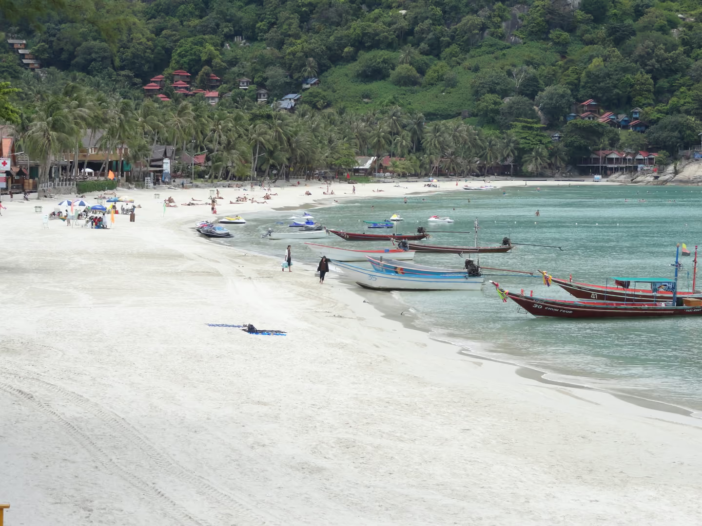
“Everyone claims they did the first Full Moon Party,” a Scottish expat told Chiang Mai CityLife in 2013 [1]. The sources bear him out. They agree on the place, Haad Rin at the southern tip of the island, which backpackers had begun to discover in the 1980s [2], and on the venue most often named, Paradise Bungalows. They disagree on the year.
The version with names attached comes from a 2011 Ministry of Culture study. Bungalow owners, it says, threw farewell seafood barbecues for departing guests on full moon nights, when the moonlight lit the beach. The ones who started it were Sutthi Kuekamon and Phiphit Ratrak, owners of Paradise Bungalow, who held such a farewell for travellers from Australia in 1987; bungalow owners and local officials then made it a monthly event [3]. The study’s source for this is a 2008 study by a Phiphit Ratrak; if he is the same man as the host, this is a founder’s own account.
Others count earlier or later. Paradise Bungalows has claimed 1983, Chiang Mai CityLife noted in 2013, although some disputed when Paradise actually opened; Bangkok Post gave the same year in 2014 [1][4]. English Wikipedia’s introduction says 1985 [5]. An islander, Sutti Kursakul, told AFP in 2016 that he held the first party around 1988 as a farewell to an Australian friend, and TIME’s 2013 account, built on a Scottish witness, also starts in 1988 [6][7].
There was competition from the start. Bangkok Post interviewed Soon Somwang, who was 18 in 1986, when her brother Wisaim and an Englishman known as Mooney held their own full moon party at a restaurant on Haad Rin Nai. She remembered a small party of about 300 locals and guests, with no body paint and no fire. Those parties ran until the early 1990s [4].
The scale changed fast. By 2013 Bangkok Post reported up to 30,000 people on Haad Rin Nok on a party night [8]. The party was suspended in 2020 because of Covid-19 and returned at full scale on 16 April 2022 [5][9][10].
For the nights of the 2027 parties and how their dates are set, see our Full Moon Party 2027 dates.
Where to see it today
- Place
- Hat Rin Nok
- Area
- Haad Rin
- Access
- Open to visitors
Chapter 16. Finished 1992 · San Chao Mae Kuan Im
A lighthouse that became a shrine
Popular storyIn short: A travel guide tells how a local woman dreamed that the goddess Kuan Im asked her to build a lighthouse for the island’s fishermen. By its account the donations went into a shrine instead, finished in 1992 on the road from Thong Sala to Chaloklum.
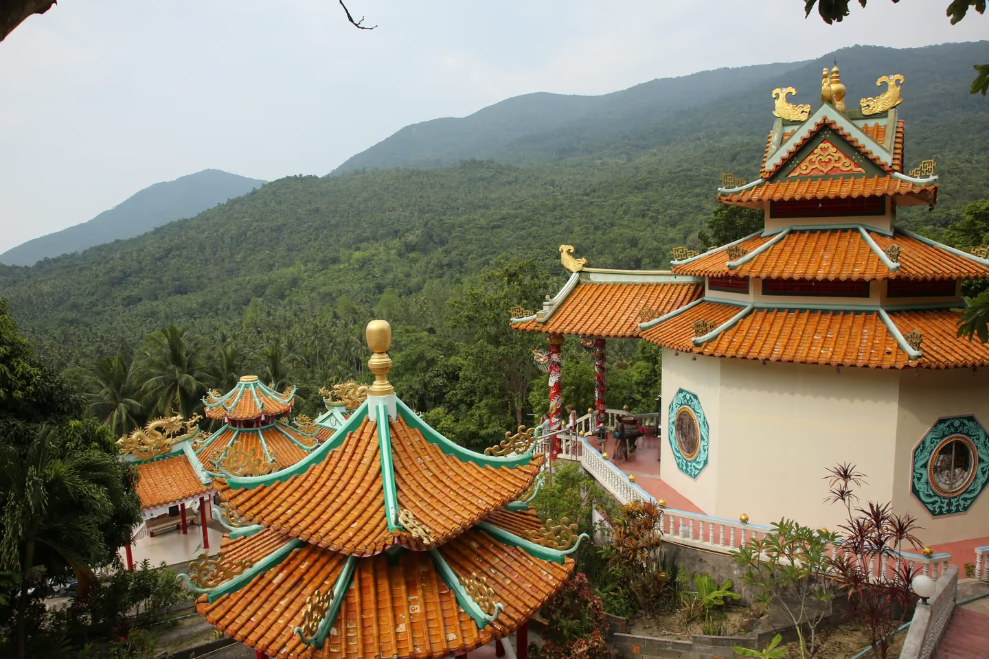

Chao Mae Kuan Im, the Chinese goddess of mercy known elsewhere as Guan Yin, has a shrine on the road from Thong Sala to Chaloklum, and its origin story is a dream. As the Thai Holiday Guide tells it, a local woman, Khun Malawan, dreamed that Kuan Im asked her to help build a lighthouse to guide the island’s fishermen safely home at night [1]. Word spread and islanders gave money. Partway through, the plan changed from a practical lighthouse to a shrine honouring the goddess, which was finished in 1992 [1].
Another English site says the building was originally used as a lighthouse and as a guide for fishermen [2]. The two accounts disagree on whether a lighthouse ever stood here or was only planned, and we found no Thai-language source to settle it. Either way, the story ties the shrine to the sea and to the boats that came home in the dark.
Thai-Chinese families from around the island come by regularly, above all around Chinese New Year and the Vegetarian Festival [1]; the island has had Chinese residents since the 19th century (see When Wok Tum was the capital). There is no fixed schedule of ceremonies and no guided information on site, and the same guide suggests early morning as the quiet time to visit. Dress modestly and take your shoes off before you step into the prayer hall [1].
Where to see it today
- Place
- San Chao Mae Kuan Im
- Access
- Open to visitors
Moo 7, on the road between Thong Sala and Chaloklum. Dress modestly and take your shoes off before entering the prayer hall.
Chapter 17. 1967 to 2018 · Nam Tok Phaeng
The monk who started a national park
DocumentedIn short: Phangan’s protected forest began with an abbot’s survey of Phaeng waterfall in the late 1960s. It outlasted a half-built airport and became a national park by royal decree only in 2018, whatever many websites say.
The forest at the heart of Phangan owes its protection to a monk. Phra Khru Suphattharathammaphirom (Luang Ta Lop), abbot of Wat Rat Charoen in Thong Sala, set out to protect the woods around Phaeng waterfall. The national park department’s own page, archived in 2007, says that in 1967 he founded the Karunamet Nam Tok Phaeng forest park and had a one-kilometre road cut to the falls, and that in 1977 he handed it to the Royal Forest Department to be declared a forest park [1]. The EcoThailand Foundation dates his survey to April 1968, the dirt road to 1972 and the official forest park, with nine paid workers, to October 1977 [2]. The Ministry of Culture report draws on his own notes [3]. Known as Luang Ta Lop, the same abbot revived the sea Chak Phra in Thong Sala bay in 1967 [4].
Then the record goes quiet. Surveys for a national park began in 1989, and in 2013 a local writer noted that it had still not been declared [1][5]. Many websites nonetheless say the park was established on 31 December 1983 and enlarged on 10 February 1999. Those dates entered Wikipedia in July 2007 from a misread official page: the first is the publication of a regulation creating a national reserved forest, the second a committee’s approval of a park proposal [6][1].
The forest was tested in 2015. From about 2012 the founder of Kan Air had been building an airport with a 1,100-metre runway on about 100 rai of former coconut land in the hills [7][10]. In 2015, after a complaint, provincial authorities suspended construction, and in September forestry officials found that land prepared for it on a mountain at Thong Nai Pan had encroached on about 20 rai of park land, in a park not yet formally declared [8]. A 2014 environmental protection zone had banned new commercial airports on the islands, though its rules were not retroactive [9]. The airport was never finished [10].
The legal birth came on 18 November 2018, when a royal decree making the forest of Koh Phangan and Ko Kong Than Sadet a national park was signed; published four days later, it covers about 43 square kilometres [11][12]. TAT counts it as Thailand’s 132nd national park [13].
Where to see it today
- Place
- Nam Tok Phaeng
- Access
- Open to visitors
Chapter 18. Surveyed 2021 to 2023 · Khao Ra
Khao Ra and the hidden mammals
DocumentedIn short: Khao Ra, about 630 metres, is the island’s highest point. A survey of the island’s forests from 2021 to 2023 found 28 mammal species where the park’s list had eight, and a Thai travel feature says the deer came as a gift from a king.
Khao Ra is the roof of Koh Phangan, though the roof’s height depends on who measured it. The national park’s own page, as archived in 2007, and OpenStreetMap both give 627 metres; English Wikipedia, citing a later park page that is now offline, gives 635 [6][1][2]. Call it about 630. The Tourism Authority of Thailand treats the climb as an expedition: every visitor must go with staff and bring medicine, food, water, a sleeping bag and proper clothes [3].
The forests on its slopes held more than anyone had listed. Between February 2021 and September 2023 a team from Suranaree University of Technology, the Naja Project Ko Pha-ngan and the Thailand Natural History Museum surveyed the island’s mammals with camera traps, night walks along transects, mist nets, live traps and drift fences. They recorded 28 species, 11 of them bats, where the national park’s species list had named a mere eight [4]. Among them were two critically endangered Sunda pangolins, both in national park forest, and 32 Sunda slow lorises, a globally endangered primate seen across the island on night surveys. Dusky leaf monkeys live here too, but the survey has a single record, an animal seen by a resident at the forest edge; no camera trap ever caught one [4].
Sambar deer appeared on the camera traps twelve times, mostly in national park forest [4]. This is where the record meets a story. A 2009 travel feature in Manager Online says the island’s deer are a royal gift: King Chulalongkorn released one male and one female on a visit to Than Sadet [5]. A 2011 research report for the Ministry of Culture repeats that the king gave deer to the park [7]. Neither cites a record of the release, none has been found, and nothing shows that today’s sambar descend from a royal pair. The deer are documented; the gift is told.
Until this survey was published in 2025, the national park’s list of mammals was eight animals long. It now has a baseline of 28, gathered with traps, nets, cameras and night walks, against which any future change on the mountain can be measured.
Where to see it today
- Place
- Khao Ra
- Access
- Open to visitors
Inside the national park. The Tourism Authority of Thailand says every visitor must go with park staff and bring medicine, food, water, a sleeping bag and suitable clothes.
Chapter 19. 1980 to 2002 · Mu Ko Ang Thong
Ang Thong, the islands of The Beach
DocumentedIn short: West of Phangan, the 42 islands of Mu Ko Ang Thong became a marine national park in 1980. CNN says Alex Garland set his novel The Beach there; the film was shot on the other side of Thailand.
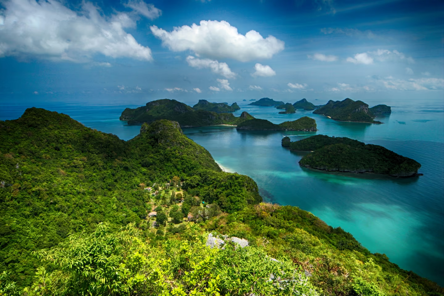

West of Phangan lies Mu Ko Ang Thong, a marine national park of 42 islands covering about 102 square kilometres, established on 12 November 1980 [1]. The Tourism Authority of Thailand, rounding, speaks of around 40 small islands about 20 kilometres from Koh Samui [2]. In 2002 the archipelago was listed as a wetland of international importance under the Ramsar Convention, site number 1184 [3].
Its best-known sight is a lake that seems not to belong. On Ko Mae Ko an emerald saltwater lake, Thale Nai, sits inside the island and connects to the sea through underwater caves [4][5]. The park’s wildlife includes dusky leaf monkeys, long-tailed macaques, smooth-coated otters and oriental pied hornbills [4]. The dusky leaf monkey is on the park’s list; on Phangan a three-year survey recorded it only once (see Khao Ra and the hidden mammals).
Then there is the novel. Alex Garland’s The Beach, published in 1996, sends its backpacker from Bangkok by way of Koh Samui to a hidden beach on an island in the Gulf of Thailand, and CNN says the book is set in Ang Thong [6][5]. The 2000 film went elsewhere: it was shot at Maya Bay on Phi Phi, on the Andaman Sea [5]. Garland wrote the book while living in the Philippines, and The Globe and Mail says the northern tip of Palawan inspired it [6][7]. Set in Ang Thong, inspired by Palawan, filmed at Phi Phi: three places for one beach. Thai National Parks adds that some sequences were filmed in Ang Thong, but cites nothing for it [4], and we found no other source.
Day trips leave from Koh Samui and Koh Phangan [2]. The park usually closes from 1 November to 15 December, depending on the monsoon [4].
Where to see it today
- Place
- Mu Ko Ang Thong
- Access
- Open to visitors
Day trips leave from Koh Samui and Koh Phangan. The park is usually closed from 1 November to 15 December, depending on the monsoon.
Glossary
Thai words on this page, in the official romanisation (RTGS).
- amphoe
- District. King amphoe is a minor district, the status Phangan had from 1970 to 1977.
- ao
- Bay, as in Ao Than Sadet.
- chak phra
- Pulling the Buddha: the festival at the end of Buddhist Lent in which a Buddha image is towed in procession, on Phangan by boat.
- chedi
- Stupa: a solid monument that may enshrine relics.
- chon salat
- Pirate. Its second word is also the name of Haad Salad; a legend links the two.
- hat
- Beach. Written Haad on local signs, as in Haad Rin.
- ko
- Island. Written Koh on local signs, as in Koh Phangan.
- luang pho
- Respectful title for a revered senior monk, as in Luang Pho Phet.
- mae chi
- A white-robed Buddhist nun. Wat Khao Tham writes the title Mae Chee.
- mae ya nang
- The female guardian spirit of a boat, believed to live in the bow.
- mueang
- Town, and in the 19th century a governed seat such as the town of Phangan at Wok Tum.
- nam tok
- Waterfall.
- rai
- Thai unit of land area, 1,600 square metres.
- ruea mat
- Slender boat seating six to eight, paddled by women in Phangan’s Chak Phra procession.
- san phra phum
- Spirit house: the small shrine for the guardian spirit of a plot of land.
- tambon
- Subdistrict. Phangan has two, Koh Phangan and Ban Tai.
- than
- Stream. The three royal streams of the east coast, Than Sadet, Than Praphat and Than Prawet, each pair it with a word for a king’s journey.
- wat
- Buddhist temple and monastery.
Visit respectfully
Temples, shrines and royal sites are places in daily use. Each rule links to the source it comes from.
At temples, cover shoulders and knees, take off your shoes before entering a building, step over the raised threshold rather than on it, keep your feet pointed away from Buddha images and never touch or point at them; women should not touch a monk or his robes.
At Than Sadet, do not carve, write on, climb or damage the rocks that carry the royal inscriptions.
Source: LoveThailand
At the Chinese shrine on the road to Chaloklum, dress modestly and take your shoes off before the prayer hall.
Source: Thai Holiday Guide
Where to stay nearby
The areas around the places in these stories. Each link opens the catalogue filtered to that area; no villa is placed here by hand.
Thong Sala
2 properties
Stories here: The temple on the small hill, Pulling the Buddha across the bay, The boat people of Thong Sala, Ferries, bungalows and a district, The nun on the cave hill
Questions and answers
What does the name Koh Phangan mean?
The usual explanation derives Phangan from lang ngan, a local dialect word for a sand ridge that surfaces at low tide. It is a local belief rather than a proven etymology. The Tourism Authority of Thailand also records an older name, Ko Raham, which it attributes to a former Ko Samui district chief and glosses as "the shadowy island".
Why is Than Sadet waterfall important?
Thai sources say King Chulalongkorn (Rama V) visited it 14 times, from 1888 or 1889 to 1909, and that four Chakri kings came in all. Royal monograms carved on the boulders record the visits, and islanders regard the place as sacred.
What is the oldest temple on Koh Phangan?
English guidebooks name Wat Phu Khao Noi and date it to about 1400, but no primary or academic source supports that date. Thai Wikipedia, citing a local website, gives 1889 for its founding by the island-born monk Luang Pho Phet.
When was the first Full Moon Party?
Sources give 1983, 1985, 1987 and 1988, all on Haad Rin. A 2011 Ministry of Culture study, citing a 2008 thesis by an author who shares his name with one of the hosts, dates the first farewell party at Paradise Bungalow to 1987, and Bangkok Post quotes a witness to a rival full moon party at Haad Rin Nai in 1986.
When did Than Sadet-Koh Phangan become a national park?
By a royal decree signed on 18 November 2018 and published in the Royal Gazette on 22 November 2018. The dates 31 December 1983 and 10 February 1999 seen on many websites refer to a reserved forest regulation and a committee's approval of a park proposal, not to the park itself.
All sources (68)read to
Primary source
- Royal Gazette vol. 135 part 98 Kor, 22 November 2018, pp. 58 to 60: Royal Decree designating the forest of Ko Phangan and Ko Kong Than Sadet a national park (in Thai)
- Royal Gazette vol. 87 part 90, 29 September 1970, p. 2790: announcement establishing the minor district of Ko Phangan (in Thai)
- Royal Gazette vol. 94 part 31, 12 April 1977, pp. 326 to 330: Royal Decree establishing Ko Phangan district (in Thai)
- Royal Gazette vol. 99 part 130, 14 September 1982, pp. 3671 to 3675: establishment of Ko Tao subdistrict (in Thai)
- Mae Chee Ahmon (7 July 2009)
- Wat Kow Tahm International Meditation Centre: home page
Official
- Nattha Khumkhwaen et al. (2011), Foreign cultures and the dynamics of the communities of Ko Samui and Ko Phangan districts (research report, in Thai)
- Ko Pha-ngan
- Observing temple and sacred site etiquette while in Thailand (29 August 2018)
- Than Sadet-Ko Phangan National Park, park page (in Thai)
- Wat Phu Khao Noi historic site (in Thai)
- TAT announces five new national parks in Thailand (August 2019)
- Mu Ko Ang Thong Marine National Park
Academic
- Pankaew and Boonsuaykwan (2015), The sea Chak Phra tradition of Ko Phangan district (in Thai)
- Aphilak Kasempholkoon (2022), The journey of the Ta Mong Lai legend from the Gulf of Thailand to local communities (in Thai)
- Nazaruddin (2020), Granite landforms of Samui Island
- Pajaree Tachart, The allure of power in Waen Wises
- Tawirat Songmuang (2024), In search of the Tanka (in Thai)
- Cook-Price et al. (2025), Mammal diversity survey of Ko Pha-ngan in Surat Thani Province, Thailand
Press
- Travel feature on Than Sadet and the royal waterfalls of Koh Phangan (in Thai, 21 October 2009)
- On Koh Phangan, the party continues (12 October 2014)
- Than Sadet-Ko Phangan becomes a national park (in Thai, November 2018)
- National film heritage list of the Thai Film Archive (in Thai, October 2013)
- Full Moon Fever (28 January 2013)
- Beats, booze and bodypaint: Full Moon Party defies Thai troubles (25 December 2016)
- Thailand's full-moon parties have become a trashy disgrace (8 July 2013)
- Phangan airport due in 2014 (2 September 2013)
- Koh Phangan suspends Full Moon Party (5 March 2020)
- Full Moon Party draws over 10,000 revellers in Phangan (17 April 2022)
- Phangan airport encroaches on forest: officials (30 September 2015)
- Islands get ecozone protection (24 June 2014)
- Royal decree designates Than Sadet-Ko Phangan National Park (in Thai, 23 November 2018)
- Ang Thong National Marine Park, Thailand (25 July 2019)
- An island of one's own: paradise found in the Philippines (1 June 2011)
Secondary
- Ko Phangan, community profile (in Thai)
- Than Sadet Waterfall National Park
- Wat Phu Khao Noi
- Wat Phu Khao Noi (in Thai)
- Amphoe Ko Phangan (district article, in Thai)
- Chao Mae Kuan Im Shrine
- Than Sadet-Ko Pha-ngan National Park, first revision (26 July 2007)
- Koh Phangan (in Thai)
- Ko Phangan (island article, in Thai)
- Ko Pha-ngan
- Ta Mong Lai (in Thai)
- Than Sadet-Ko Pha-ngan National Park
- Than Sadet, local history blog (in Thai, 17 June 2013)
- Koh Phangan temples
- Phu Khao Noi Pagoda
- Top 10 Phangan temples
- An amateur drama shot by King Rama VII has been named to Thailand's registry of films (November 2013)
- Mae Yanang
- Ban Chaloklum (in Thai)
- Haad Salad
- Hat Khuat
- Ko Pha-ngan
- Ban Hin Kong, village (node 2421201804)
- Hat Rin
- Rosemary and Steve Weissman
- Full Moon Party
- Phangan National Park
- Ko Pha-ngan Airport
- Khao Ra, peak (node 1828269542)
- Mu Ko Ang Thong National Park
- List of Ramsar sites in Thailand
- Mu Ko Ang Thong National Park
- The Beach (novel)
How we checked
We built this page from a research file of more than 130 claims about the island's history, legends and nature. Each claim was checked again against its source in a separate fact-check. Claims that could not be confirmed were dropped; claims that were only partly supported were rewritten to say what the source says. Thai-language sources, among them the Royal Gazette, Ministry of Culture reports and articles in Thai academic journals, were read in the original. Every chapter lists its sources and the date they were checked.
Where sources disagree we print both versions instead of choosing one. Dates we cannot pin down carry a c. for circa. Place names in the text use the spelling common on the island's signs and maps (Haad Salad, Chaloklum); the official Thai romanisation (RTGS) is given at first mention, in each chapter's place line and in the list under the map (Hat Salat, Chalok Lam). Thai words follow RTGS, as the glossary explains. Accounts told on the island appear only when a named source has written them down.
- Stories
- 19
- Sources
- 68
- Dates on the timeline
- 44
- Last checked
- 5 October 2026